
Need Safe Sites? Use Surveying And Mapping
A bulldozer driver hits a high-pressure gas line, and suddenly, a routine workday turns into a multimillion-dollar disaster. The ground shakes, the project stops, and lawyers start billing. This happens because someone looked at a flat piece of dirt and saw a blank slate. In reality, every acre of land holds layers of buried history and physical tension. Using professional surveying and mapping changes the way you see the ground. It turns a guessing game into a clear plan. Without it, you invite sinkholes, lawsuits, and broken budgets. A single mistake in land measurement can move a foundation onto a neighbor's lot or into a flood zone. Professional data reveals what the naked eye misses. This guide shows how to stop these disasters before the first shovel hits the dirt.
Why Surveying and Mapping Is the First Line of Defense
Safety starts long before the crew arrives on site. It begins with a comprehensive data profile. Professional surveying and mapping serve as the primary shield against unpredictable site conditions. Documenting every physical detail removes the element of surprise from the construction process. This proactive approach saves lives and protects your capital.
Identifying Buried Subsurface Utilities
Striking an underground utility creates immediate danger for workers and local residents. According to the Common Ground Alliance 2024 DIRT Report, the CGA Index for utility damage recently rose to 96.7. This surge indicates a growing risk for developers who ignore buried infrastructure. The Occupational Safety and Health Administration notes that contacting state one-call centers like 811 helps prevent utility damage, as failure to do so accounts for over 24% of all utility strikes. Surveyors solve this by using Ground Penetrating Radar (GPR).
According to TWI Global, GPR systems utilize high-frequency radio waves operating between 10 MHz and 2.6 GHz. The same organization explains that higher frequencies provide better resolution for shallow hazards like rebar, while lower frequencies penetrate further into the earth to detect deep voids or large pipes. Furthermore, according to the Common Ground Alliance 2024 DIRT Report, telecommunications and natural gas lines are the most common strike targets. Accurate maps give your team X-ray vision into the earth.
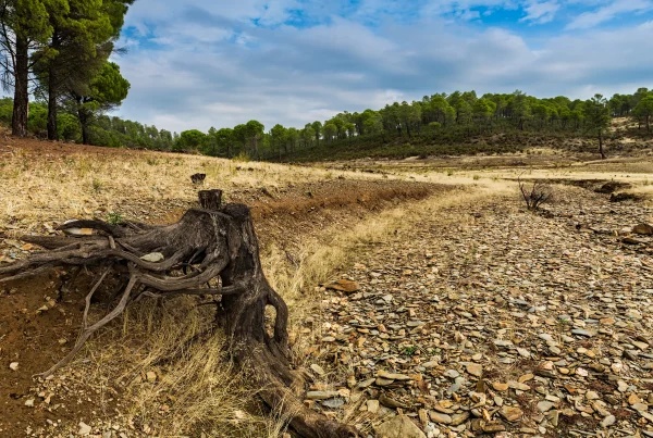
Assessing Terrain Stability and Geohazards
Unstable ground can swallow a project's profit and its physical structure. Surveyors look for signs of sinkholes, seismic fault lines, and shifting soil. Why is a land survey necessary before building? A professional survey establishes legal boundaries and identifies physical constraints that ensure the safety and legality of the structure. Without this data, you might build on a ticking time bomb. Professional surveying and mapping identify these threats in the planning stage. Surveyors use geodetic methods for sites larger than 250 square kilometers to account for the Earth's curvature. This precision prevents measurement drift that leads to structural instability.
Using Topographic Data to Prevent Structural Failure
As noted by the United States Geological Survey, topographic maps record the geographic positions and elevations of natural and man-made features, showing how surface features dictate how a building interacts with the environment. If you ignore the slope or the soil, the environment eventually wins. High-quality topographic data allows engineers to work with the land rather than against it. This information determines where water goes and where the ground might give way.
Managing Drainage and Flood Risks
Water is the most common cause of long-term property damage. To fight this, the United States Geological Survey explains that because contour lines illustrate the shape of the land and the steepness of slopes, surveyors collect detailed topographic data to model water flow.
Guidelines published by the Federal Emergency Management Agency recommend that digital elevation models use contour intervals of four feet or less, specifically suggesting 2 feet for flat terrain. A separate agency training document notes that plotting cross sections and profiles on a topographic map allows this level of detail to help calculate Base Flood Elevations with high precision. Returning to the agency's November 2024 guidance on elevation data precision, if your land measurement is off by even a few inches, your foundation could end up in a flood zone.
This leads to mold, structural rot, and massive insurance hikes. Proper mapping ensures that drainage systems move water away from your assets. You avoid the bowl effect, where a site traps water and ruins the build.
Mitigation of Soil Erosion and Landslides
According to the British Geological Survey, adding water to the material on a hillside makes a landslide more likely, meaning slopes that look safe can become deadly during heavy rain. The same institution emphasizes that slope angle is a key variable, and geotechnical surveyors use topographic maps to assess this steepness to calculate the Factor of Safety for a hillside. Any score below 1.0 means the slope is at risk of imminent failure. Grades steeper than 15% require specific reinforcement or retaining walls. What are topographic maps used for? These maps provide a detailed representation of the Earth's surface features, allowing engineers to identify potential drainage or elevation hazards before construction begins. Identifying these steep zones early allows you to plan for soil stabilization. This prevents landslides that could bury equipment or neighboring properties.
Reducing Liability Through Precise Land Measurement
Legal hazards are just as dangerous as physical ones. A boundary dispute can freeze a project for years. Precise land measurement ensures that every square inch of your project stays within legal limits. This protects you from lawsuits and keeps your neighbors satisfied.
Establishing Legal Setbacks and Clearances
Every municipality has rules about how close you can build to a road or a power line. Surveying and mapping identify these no-build zones with surgical precision. Professional land measurement keeps your structure a safe distance from high-voltage lines and flammable zones.
Based on a Federal Emergency Management Agency document regarding the conversion of unrevised flood elevations, using the NAVD 88 standard ensures your vertical measurements meet all legal flood-plain requirements. One small error in your setback could force you to tear down a completed wall. Surveyors prevent this by marking clear, legally defensible lines on the ground. This creates a safety buffer between your project and the surrounding world.
Resolving Boundary Encroachments
Property lines are often messy and misunderstood. According to a Bureau of Land Management report, the Land Ordinance of 1785 established a rectangular survey system that created a grid of townships containing 36 one-square-mile sections to bring order to the land. Even with this system, overlapping claims happen. Professional land measurement identifies exactly where your property ends and the next one begins. If your fence or foundation crosses a line, you face a boundary encroachment. This can lead to forced demolition and heavy fines. Surveyors verify your bundle of rights, ensuring you don't interfere with public easements or hazardous utility corridors. Knowing your exact acreage prevents you from paying for land you don't own or building on land you can't use.
Modern Technologies in Surveying and Mapping
The tools of the trade have evolved from simple chains to high-speed lasers. Modern surveying and mapping uses light and radio waves to capture data that was once impossible to get. These technologies increase accuracy while keeping human surveyors out of harm's way.
Using LiDAR and Drones for Remote Sensing
Aerial LiDAR is a game-changer for site safety. It offers vertical accuracy within 1 to 3 centimeters. Drones can fly over dangerous terrain, such as steep cliffs or swampy marshes, while the operator stays safe. LiDAR produces over 300 points per square meter, allowing.
Integrating Data through Geographic Information Systems (GIS)
Collecting high-precision data is only effective if it is accessible and actionable for the entire project team. Geographic Information Systems (GIS) act as the central nervous system for site safety, layering utility maps, topographic scans, and legal boundaries into a single, interactive "digital twin" of the property.
This spatial integration allows project managers to visualize how various hazards interact, for example, seeing how a proposed drainage path might overlap with a buried fiber-optic line or a sensitive environmental setback. Moving data from static paper maps to active digital platforms allows stakeholders to update site conditions in real-time as the project evolves. This ensures that the excavator operator, the site engineer, and the safety inspector are all operating from a single source of truth, virtually eliminating the communication gaps that lead to on-site accidents and costly delays.
From Uncertainty to Precision
Professional surveying and mapping represent the definitive line between a successful development and a catastrophic failure, rather than being administrative checkboxes. These tools strip away the concealment of buried utilities, the instability of steep slopes, and the legal ambiguity of property lines as they transform an unpredictable "blank slate" into a detailed data profile.
The integration of modern technologies like LiDAR and GPR has shifted the industry from reactive damage control to proactive risk management. When developers use high-resolution topographic data and precise vertical measurements, they protect their workforce, their capital, and their reputation instead of simply following regulations.
Ultimately, the cost of a professional survey is a minor investment compared to the multimillion-dollar price tag of a utility strike, a structural collapse, or a boundary lawsuit. Data is the ultimate safety gear within the high-stakes environment of land development. Prioritizing accurate mapping before the first shovel hits the dirt ensures that your project is built on a foundation of certainty rather than a gamble.
Recently Added
Categories
- Arts And Humanities
- Blog
- Business And Management
- Criminology
- Education
- Environment And Conservation
- Farming And Animal Care
- Geopolitics
- Lifestyle And Beauty
- Medicine And Science
- Mental Health
- Nutrition And Diet
- Religion And Spirituality
- Social Care And Health
- Sport And Fitness
- Technology
- Uncategorized
- Videos