
Precise Geomatics Tools Drastically Cut Site Costs
You pour millions into a new commercial development, confident in the budget, only to watch profits vanish because the ground beneath your feet slopes two inches lower than expected. A minor grading error forces crews to haul extra dirt, delaying construction by a week and ruining your margins before laying a single brick. Construction budgets often bleed out through tiny, compounding measurement errors. Project managers rely on outdated surveying methods that capture limited points on a massive grid, assuming the spaces in between remain perfectly flat. We deploy Geomatics as the authoritative solution to stop this financial bleeding. Advanced data techniques shift project managers from costly guesswork to absolute certainty. You relieve the intense stress of managing tight margins when you map the exact physical reality of your job site flawlessly from day one.
The Concealed Financial Drain of Traditional Site Planning
Outdated surveying techniques create a massive financial ripple effect across your entire build schedule. Traditional teams walk a site with standard optical equipment, grabbing elevation points every fifty feet. They leave huge gaps in the terrain data. When heavy excavators finally roll onto the site, contractors find sudden dips or rocky outcrops concealed between those widely spaced measurement points. A single missed boulder or unexpected slope forces immediate work stoppages. You suddenly pay for emergency material deliveries, extra equipment rentals, and idle labor hours. These minor initial measurement errors compound rapidly. Moving earth costs significant money. Re-moving earth because someone misread the grade costs twice as much. Your project hemorrhages cash while teams wait for new instructions. Standard measuring tools simply fail to provide the complete site picture required to protect modern construction budgets.
The Cost of Guesswork
Guesswork actively destroys profit margins during the initial site preparation phase. Imagine paying a standard crew to map an urban industrial zone. The team falls back on classical total-station plotting because surrounding metal buildings scramble their basic radio signals through multipath interference. They guess the exact location of critical underground pipes based on old municipal drawings. The excavator operator digs down and strikes an unmarked water main. The entire site floods instantly. You face catastrophic utility disruptions, mandatory project pauses, and massive repair fines.
According to a report by the North Carolina Chapter of the American Public Works Association, which highlights a nearly 30% drop in planning and building expenses, data from Subsurface Utility Engineering shows that mapping these utilities precisely before breaking ground generates an average 29% reduction in overall design and construction costs. Furthermore, a publication by the Federal Highway Administration confirms that SUE can save transportation agencies hundreds of thousands of dollars through the avoidance of unexpected utility encounters during construction, a stark contrast to relying on visual estimations or outdated maps that guarantees sudden issues. You ultimately fund these expensive derailments directly from your hard-earned operational profits every single time.
Shifting from Reactive to Proactive Planning
Smart contractors adopt a proactive mindset to prioritize upfront, high-density data collection over fixing expensive errors later. French-Canadian surveyor Michel Paradis popularized this shift in nineteen eighty-one when he urged traditional land surveying to merge with modern data capture. He knew manual land mapping could never survive modern spatial demands. You must build an integrated space-air-ground network using real-time cloud computing and multidimensional sensors to map the earth completely. You catch errors in a digital environment instead of paying an entire construction crew to stand around while engineers solve a physical problem. You establish a single source of truth for every contractor on the project. Everyone works from the same highly precise model. This strategic mindset shift stops budget leaks entirely as it ensures your team solves difficult site problems before they physically exist.
Understanding How Geomatics Changes Site Surveys
According to Esri, which notes that geographic information systems are utilized to build, organize, evaluate, and visualize diverse information, the International Organization for Standardization defines Geomatics as the discipline concerned with the collection, distribution, processing, and presentation of geographic data.
What is the difference between surveying and geomatics?
Surveying focuses primarily on physically measuring land boundaries, whereas geomatics is a broader discipline encompassing the collection, analysis, and digital management of all spatial data. This broader discipline directly protects profit margins through the creation of an infallible digital model. Teams integrate GPS technology, satellite imagery, and advanced digital modeling to form a flawless replica of the physical world. Roger Tomlinson created the first computerized geographic information system back in 1963 to solve massive mapping delays. His digital overlay methods reduced a three-year manual task into a quick project costing a fraction of the original price. Modern site analysis utilizes these exact foundational digital concepts.
From Manual Checks to Digital Precision
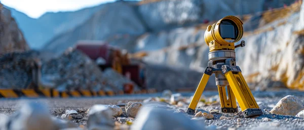
Old manual transit methods demanded endless walking, physical stakes, and basic geometry to map an environment. Crews spent weeks charting large parcels, vulnerable to human fatigue and poor weather. Today, surveyors mount mobile mapping systems onto standard vehicles. These advanced cameras and lasers capture a fifty-kilometer road network in merely two hours of driving. A traditional manual team requires six weeks and expensive traffic management crews to match that output. Real-Time Kinematic GPS methods use double-frequency receivers to correct phase errors instantly, delivering horizontal position accuracies down to forty-one millimeters. You stop relying on tired humans squinting through optical lenses in the rain. Automated data-gathering techniques record millions of precise measurements per second. Contractors pull sub-centimeter accurate terrain details straight into their computers, cutting direct surveying costs drastically while achieving vastly superior project accuracy.

Deploying spatial data mapping as Your First Line of Defense
Project teams prevent physical clashes through heavy reliance on advanced spatial data mapping. Software tools like the Feature Manipulation Engine merge diverse geographic datasets to ensure sub-centimeter positional accuracy across different platforms. How is spatial data mapping used in construction? Contractors utilize it to create highly accurate digital twins of a site, allowing teams to identify structural clashes and logistical risks before any physical work begins. A digital twin reveals exactly where new underground plumbing intersects with existing electrical grids. You identify these spatial conflicts safely on a computer monitor instead of discovering them with a backhoe. Terrestrial laser scanning captures precise measurements to help contractors pre-fabricate pipes and steel components off-site flawlessly. Teams navigate potential logistical flaws digitally, adjusting angles and elevations virtually. This virtual foresight eliminates costly rework completely from the timeline.
Visualizing Difficult Site Data
Translating raw numbers into digestible three-dimensional visual models helps the entire crew understand difficult site challenges immediately. Staring at endless spreadsheets of elevation coordinates confuses even experienced site managers. Jack Dangermond established the Environmental Systems Research Institute back in 1969 to solve this exact problem. His software transformed dense numerical data into intuitive visual maps, a practice thousands of global organizations actively utilize today. Modern teams upload millions of laser points into modeling software to render a photorealistic version of the job site. Engineers spin the model around, zoom into tight corners, and inspect the structural integrity visually. This visual clarity bridges the gap between technical surveyors and the laborers moving dirt on the ground. Everyone sees the exact same physical obstacles clearly, preventing dangerous misinterpretations and ensuring every contractor understands the objective.
Collaborative Mapping for Stakeholders
Shared maps keep remote contractors, engineers, and clients perfectly aligned to reduce miscommunication errors across state lines. A fully immersive, web-accessible terrestrial laser scan entirely removes the need for engineering teams to fly across the country. You instantly eliminate expensive flights, daily per diems, and hotel accommodations for multiple experts. The initial scanning investment pays for itself within weeks just through the reduction of these executive travel costs. A structural engineer in New York logs into the shared platform to inspect a foundation problem in Texas simultaneously with the local foremen. They mark up the exact same three-dimensional model in real time. Everyone agrees on the required materials and updated timelines instantly. You remove the lengthy email chains and conflicting paper schematics that usually delay urgent project decisions. Collaboration becomes instantaneous, visual, and indisputably accurate today.
Applying gis topography to Prevent Costly Earthwork Errors
Understanding the physical terrain thoroughly requires the incredible precision of modern gis topography tools. According to the Harvard Gazette, Howard Fisher established the Laboratory for Computer Graphics and Spatial Analysis at the Graduate School of Design in nineteen sixty-five, producing the algorithmic baseline for these exact digital systems. Surveyors capture exact elevations across every square inch of the property. What does gis topography show?
According to Esri documentation, which states that identifying topographic curves assists in evaluating the amount of material removal needed, contour lines help with estimating excavation work; thus, it displays the exact 3D elevation, slopes, and physical contours of a terrain, helping engineers accurately calculate earthwork volumes to prevent expensive over-excavation. You never pay a crew to dig deeper than structurally necessary. Moving soil represents one of the largest variables in any civil engineering budget. Precise spatial calculations optimize hauling logistics entirely. Contractors know exactly how many dump trucks to order for the week. You eliminate paying drivers to sit idle while waiting for an excavator to hit the correct foundation depth on site today.
Calculating Cut-and-Fill Volumes Accurately
Relying on visual estimations to order dirt guarantees massive cost overruns. Modern contractors utilize unmanned aerial vehicles to capture detailed orthomosaics. They calculate the exact cubic yardage of material stockpiles and perform highly accurate daily cut-and-fill analyses. Exact topographical data prevents buying too much fill dirt or paying for unnecessary soil removal. You know precisely how much dirt exists in pile A and exactly how much you need to fill hole B. Advanced spatial data mapping software calculates the difference instantly. Managers avoid ordering ten extra truckloads of topsoil that just wash away in the next storm. Accurate earth-moving payments ensure you only compensate subcontractors for the exact volume of earth they physically relocated. This data-driven approach removes all disputes over hauling invoices and keeps your earthwork budget locked firmly in place forever.
Managing Drainage and Runoff Risks
Ignoring natural water flow early in the design phase creates expensive liabilities when extreme weather hits the completed site. Flooded parking lots and washed-out foundations ruin a company's reputation instantly. Engineers use accurate gis topography combined with soil infiltration data and catch-basin mapping to model exact site runoff. They design Green Stormwater Infrastructure properly. Predicting water movement ensures you calculate the absolute minimal grading required to keep the site dry. Proper runoff models help developers avoid excessive pavement removal, which lowers heavy municipal drainage charges significantly. You build retention ponds in the exact optimal location rather than guessing where water might pool. Precise fluid modeling prevents costly lawsuits from neighboring properties claiming your new development flooded their land. Accurate terrain data keeps your project entirely compliant with strict environmental water regulations every season.
Essential Geomatics Tools That Directly Reduce Project Overhead
Modern spatial analysis requires serious computing power and specialized field instruments. Implementing Geomatics effectively demands advanced hardware that delivers immediate financial returns. Advanced three-dimensional point clouds and hyperspectral imagery generate massive datasets that strain legacy computer networks. Companies must invest in high-performance cloud processing platforms to handle gigabytes of scanning data per hour. Cost and resolution trade-offs exist constantly in this industry. Small municipalities often find jumping from a broad thirty-meter resolution to a precise half-meter resolution incredibly expensive. However, upgrading from basic surveying equipment to advanced spatial tools always pays off in large-scale commercial developments. Fast mapping tools actively map heavy traffic density on active material sites to prevent expensive equipment collisions. The modern toolkit protects workers, prevents costly mistakes, and speeds up the construction timeline drastically across the entire board today.
Drones and UAVs for Rapid Site Capture
Unmanned Aerial Vehicles changed the speed of large-scale property surveying. Drones outfitted with multi-frequency Post-Processed Kinematic receivers capture thousands of high-resolution overlapping images from the sky. Photogrammetry software processes this imagery to deliver an absolute horizontal accuracy down to one centimeter and a ground sampling distance of less than an inch. A drone executes a highly accurate spatial survey of a massive hundred-hectare rock quarry in just one hour. Traditional surveying teams take five hours to cover that exact same ground. This rapid aerial capture achieves an incredible 85% reduction in topographical survey time. Remote sensing completely removes human workers from hazardous terrain and active equipment paths. You eliminate the thirty-five-thousand-dollar baseline cost of a single lost-time injury while gathering far better mapping data at a significantly faster pace safely. You easily protect your budget while improving daily operations.
LiDAR Scanners for Millimeter Accuracy
Light Detection and Ranging tools use active laser pulses to capture millions of data points per second. Paired with satellite navigation, LiDAR generates incredibly dense three-dimensional point clouds instantly. Surveyors bypass heavy forest vegetation easily to generate precise bare-earth elevation models. As explained by the U.S. Geological Survey, because the light emissions are able to slip through the spaces among foliage and branches, the lasers penetrate the gaps between leaves to measure the true dirt level below.
Sensor fusion methodologies merge global positioning coordinates with these localized laser scans to maintain precision in active environments like airborne surveying or marine mapping. The technology compensates for active shifts in real time. Planners never guess about terrain features concealed beneath thick brush or murky water. You capture the microscopic details of a jagged rock face or a steep ravine flawlessly. This hyper-accurate ground modeling guarantees contractors price their excavation bids perfectly without padding their financial quotes for unknown terrain risks.
Accelerating Regulatory Approvals With Clear Spatial Insights
Obtaining building permits often drains a project budget through endless administrative delays and expensive holding costs. Municipal planning boards demand extensive proof that your new commercial development respects local regulations. Comprehensive spatial packages speed up this permitting process immensely. You submit clear, mathematically perfect models instead of vague hand-drawn property lines. Officials approve projects faster when they trust the base geographic data. Developers utilize Geomatics to verify difficult boundaries before submitting their final municipal paperwork. They prove environmental compliance definitively using detailed topographic overlays. When you eliminate back-and-forth arguments with city inspectors, you break ground much sooner. Cutting two months off the permitting timeline saves tens of thousands of dollars in high-interest construction loans. Accurate property data cuts through the municipal red tape quickly, turning a bureaucratic nightmare into a smooth, predictable administrative process today.
Navigating Zoning Laws with Hard Data
Zoning laws dictate strict setbacks, building heights, and protected environmental boundaries. Violating these rules accidentally leads to massive fines or orders to tear down completed structures. Precise spatial data mapping proves your compliance with these complicated setback rules instantly. You overlay the city zoning requirements directly onto your three-dimensional site model. You see immediately if the corner of your planned warehouse crosses a protected wetland buffer by two inches. Adjusting the building footprint digitally takes five minutes. Moving a concrete foundation physically takes three weeks and ruins your profit margin. Hard data removes all subjectivity from the zoning conversation entirely. City planners accept precise drone surveys and laser scans as absolute factual reality. Presenting undeniable mathematical proof that your development perfectly matches the approved municipal zoning code allows you to avoid costly legal disputes with neighborhood associations.
Producing Ironclad Compliance Reports
Regulatory boards demand constant updates and official documentation throughout the lifecycle of a build. Manually typing up these extensive progress reports wastes hundreds of valuable engineering hours every single month. Modern Geomatics software auto-generates authoritative, indisputable reports for these strict regulatory boards with one click. The software pulls the precise laser measurements, the drone imagery, and the updated topographical models into a standardized municipal format instantly. Your team hands the inspector a pristine digital packet documenting exactly how much earth you moved last week. These ironclad reports protect developers from sudden municipal audits and false claims of environmental damage. When a city official asks for drainage proof, you hand them an engineered fluid model instantly. You eliminate administrative delays, keep inspectors satisfied, and guarantee the construction site remains fully open and profitable all year long.
Maximizing ROI Through Automated Geomatics Workflows
Upfront technology investments frequently intimidate developers who already operate on incredibly thin financial margins. However, integrating Geomatics methodology into transport and infrastructure builds changes these temporary costs into massive financial gains. According to rigorous cost-benefit analyses, adding advanced spatial modeling costs about 0.4% of the total project expenditure. Surprisingly, this tiny investment yields an average return on investment of three hundred and 40%. Planners achieve this incredible ROI through a massive reduction in expensive rework and endless change orders. Upfront tech investments drastically shrink labor hours and equipment rental times over the complete lifespan of a build. You stop paying skilled laborers to stand around while foremen puzzle over mismatched paper drawings. Implementing automated spatial workflows guarantees financial predictability, driving your operational overhead down and pushing your overall project profitability skyward.
Reducing Labor Hours on the Field
Field labor represents the most expensive and volatile line item on any standard construction ledger. Faster data collection frees up human capital for other profitable tasks across the job site. Traditional surveying forces a team of three to hike across difficult terrain for weeks just to establish baseline elevation points. Drones and mobile laser scanners perform that exact same task in a single afternoon. You immediately reassign those skilled workers to actively manage the physical construction process rather than passively measuring dirt. Accurate spatial models calculate the exact volume of concrete needed for the foundation pour. Foremen never pay workers overtime to wait for emergency concrete deliveries after underestimating the required volume. You streamline the entire workforce schedule around reliable mathematical data, ensuring every paid labor hour directly advances the physical completion of the project.
Eliminating the Rework Budget
Getting the foundational details right the first time digitally drops the dreaded rework budget to near zero. Tearing out installed plumbing because it hits an unforeseen concrete footing destroys your profit margin instantly. Rework forces developers to buy the exact same materials twice and pay the labor force double to complete a single task. Comprehensive spatial data mapping catches every structural conflict virtually before the crew ever breaks ground. You test structural tolerances inside the computer model. You adjust the routing of HVAC vents around steel support beams digitally. Once the digital twin functions flawlessly, the physical build proceeds without a single interruption. Contractors follow the verified data blindly, knowing the measurements guarantee a perfect fit. Erasing the rework phase entirely turns a chaotic, unpredictable building process into a highly profitable, streamlined manufacturing operation.
Securing Your Bottom Line with Geomatics
Modern construction simply leaves no room for geographical guesswork. The strategic combination of spatial data mapping and precise gis topography creates an impenetrable defense against sudden budget overruns. Adopting Geomatics effectively protects every dollar you invest through the elimination of the tiny measurement errors that historically drain construction budgets dry. You gather immense amounts of terrain data upfront to map out absolute certainty before laying a single brick. Project managers confidently orchestrate massive earth-moving operations, knowing exact topographical calculations prevent wasted labor and excess material costs. Handing regulators undeniable mathematical proof of compliance lets you sidestep bureaucratic municipal delays effortlessly. Implementing these advanced tools permanently removes the chaotic financial anxiety of the initial site preparation phase. Total spatial awareness turns risky land development projects into predictable, highly controlled, and incredibly profitable commercial successes from the very first day.
Recently Added
Categories
- Arts And Humanities
- Blog
- Business And Management
- Criminology
- Education
- Environment And Conservation
- Farming And Animal Care
- Geopolitics
- Lifestyle And Beauty
- Medicine And Science
- Mental Health
- Nutrition And Diet
- Religion And Spirituality
- Social Care And Health
- Sport And Fitness
- Technology
- Uncategorized
- Videos