Image Credit - by John a s - Own work, CC0, via Wikimedia Commons
England Coast Path: Walking A Changing Shoreline
When a government attempts to draw a permanent line along the edge of the sea, the ocean immediately begins erasing it. The newly designated King Charles III England Coast Path promises an unbroken route around the entire country. However, establishing a permanent trail on a constantly crumbling shoreline guarantees an endless battle between legislation and landslips. Walking this route means navigating an environment that actively rewrites its own boundaries every single day.
The England Coast Path stretches across thousands of miles of terrain that refuses to sit still. This project exposes a massive logistical reality. Taming the British coastline demands aggressive physical labor. It also requires a legal framework that can literally move backwards. Developers aim to link isolated salt marshes, vast sandy shores, towering cliffs, rolling dunes, and ancient historic settlements into one unbroken shoreline connection. Hikers attempt to conquer a trail that the ocean relentlessly tries to consume.
The Political Marathon Behind the England Coast Path
Creating a national border for pedestrians requires outlasting the politicians who approve it. Project leaders launched this initiative nearly two decades ago, yet the physical trail outlived the governments that originally funded it.
Surviving Seven Administrations
According to a report by The Guardian, officials under the Gordon Brown administration first initiated this 2,689-mile path 18 years ago. Some supporting documents note a 16-year timeline, but either way, the creation of this trail required immense bureaucratic endurance. During its development, the United Kingdom saw an astonishing leadership turnover. Seven different Prime Ministers took office while trail builders mapped the route. Developers had to secure consistent funding, push legislation through parliament, and maintain project momentum across entirely different political periods. Keeping a geographical project alive through multiple regime changes proves incredibly difficult.
Breaking Through Legal and Global Delays
Planners originally set an ambitious target deadline of 2020. Severe schedule disruptions quickly derailed this timeline. As detailed in a government variation report, an April 2018 European Court judgment forced developers to pause progress and change how they assessed the trail's environmental effects. Furthermore, documentation from Natural England notes that disruptions caused by COVID-19 significantly extended consultation periods, delaying physical trail construction for months. Despite these setbacks, the project survived. Environment Secretary Thérèse Coffey eventually renamed the route to commemorate the royal coronation in May 2023, giving the initiative a fresh surge of public attention. Today, developers aggressively target the end of the current year to achieve full remaining path accessibility, pushing construction crews to close the final gaps.
A Legal Loophole That Opened Up the Shoreline
Granting access to a specific trail accidentally opens up thousands of acres of forbidden land. Drawing a simple line on a map drastically alters the property rights of the terrain surrounding it.
The Post-WWII Ramblers Campaign
The origin of this route traces back to the years following WWII. The Ramblers charity campaign spent decades advocating for total coastal freedom. Their relentless pressure finally led to the passage of the Marine and Coastal Access Act in 2009. Jack Cornish, a director at the Ramblers, considers this legislation a groundbreaking access expansion that changed the face of British hiking. He notes that the law enables an authentic appreciation of national maritime borders, connecting modern citizens with ancient naval environments. Walkers no longer have to stare at fenced-off beaches from a distance. The new legislation permits the unrestricted exploration of sandy shores, allowing the public to physically interact with the nation's rugged edge.
Entering the Crown’s Intertidal Zone
The 2009 legislation established an open zone running all the way down to the tidal boundary. This "coastal margin" gives the public legal entry to previously restricted beaches, dunes, and cliff-tops. Most of this intertidal zone legally operates as Crown property, though certain exceptions exist. How much of the England Coast Path is finished? Currently, hikers enjoy full access to around 80 percent of the trail, though some regional estimates indicate a target for complete nationwide accessibility by spring. Exploring these margins comes with strict limitations. As outlined by the West Sussex County Council, authorities strictly enforce a coastal margin restriction that excludes camping, cycling, and horse riding from the new public access rights within these newly opened spaces. Walkers earn the right to roam, while landowners maintain the right to prevent permanent occupation.
Walking the England Coast Path Means Dodging Nature’s Landslips
A hiking route built on eroding cliffs guarantees the map is outdated the moment you print it. Planners must constantly surrender territory to the very ocean they want visitors to admire.
The Charmouth Cliff Collapse
Climate change and natural erosion force the trail to physically retreat on a regular basis. In early February, a massive cliff landslip entirely destroyed a section of the path outside Charmouth in Dorset. The earth simply gave way, taking the established walking route down into the turbulent sea. South West Coast Path Manager Lorna Sherriff oversaw the immediate trail closure to prevent public tragedy. Her team quickly executed an alternative street route deployment to keep hikers moving away from the dangerous fracture lines. This specific Dorset diversion added an extra 1.5 miles to the route. Hikers walking the coast must accept that the ground beneath their feet possesses an unpredictable lifespan, threatening to vanish after any major storm.
The Legal "Roll-Back" Provision
Planners anticipated environmental destruction and embedded a genius legal defense directly into the trail's foundation. Does the England Coast Path move? Yes, the route actively relocates inland using special "roll-back" laws whenever coastal erosion or sea-level changes destroy the cliff edge. This climate adaptation tactic saves the trail from permanent closure. In Dorset, authorities utilized this rule to execute a swift 15-metre inland shift. Sherriff points out that this inland shifting rule completely prevents extensive bureaucratic delays that could leave the trail closed for years. Instead of asking parliament for permission to redraw the map, trail managers instantly and legally move the path backward to keep the route completely open.
Mapping the Geographic Jigsaw Puzzle
Stitching together an unbroken trail actually reveals the permanent gaps you cannot cross on foot. Building a unified coastal route requires admitting that certain rivers and estuaries simply refuse to be bridged.
Absorbing Hundreds of Miles of Legacy Trails
Instead of carving a completely new path out of the dirt, developers integrated massive existing routes into the overall plan. The England Coast Path swallowed the famous 630-mile South West Coast Path. Planners also absorbed the 185-mile Cumbria Coastal Way and the 163-mile Saxon Shore Way. Connecting these established segments saved decades of manual labor and endless legal disputes over land ownership. Project Lead Neil Constable views this seamless integration as a phenomenal achievement that redefines the country's hiking infrastructure. The trail forms a world-class outdoor asset by uniting highly disparate regional walks into a single, aggressively branded national adventure.
The Permanent Crossings and Interruptions
Even with clever integration, the unbroken shoreline connection features undeniable continuity gaps. Nature interrupts the walk. In the north-west, hikers face a complete trail stop and rely on a Mersey ferry dependency to cross the water. In south Devon, walkers must time their trek perfectly to execute a River Erme low-tide transit, testing their schedule against the lunar cycle. Supporting sources even highlight the necessity of taking a train ride across the Furness and Cartmel peninsulas to bypass impassable mudflats. At the national borders, the trail smoothly connects with Offa's Dyke Path in Wales and the Berwickshire Coastal Path in Scotland, transforming a regional trail into an international network.
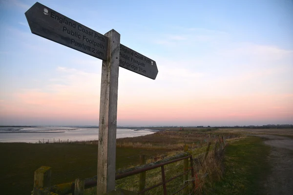
Image Credit - by Sedgemoor : England Coast Path by Lewis Clarke, CC BY-SA 2.0, Wikimedia Commons
Breaking Down the Numbers of the Coastal Walking Route
Setting a concrete target for an entire coastline forces officials to constantly redefine the total distance. Measuring a jagged, crumbling edge yields a different mathematical result depending on who holds the tape measure.
The True Distance of the Route
Official documentation lists the total route length at 2,689 miles. However, some supporting materials round this figure up to roughly 2,700 miles. Regardless of the exact digit, project leaders successfully mapped out more than 1,000 miles of entirely new trail additions. This massive expansion solidifies its status as the world's longest managed coastal walking route. Walkers navigate a vast geographical portfolio featuring isolated dunes, rocky outcrops, and densely populated historic port towns. Every added mile represents a legal victory over private land disputes and physical terrain challenges.
Walking the Great Britain Perimeter
The scale of the entire island dwarfs the English section alone. Scotland holds an estimated 5,500 miles of coastline. The Wales Coast Path covers an additional 870 miles. Combining these regions creates a Great Britain coastal route potential of approximately 9,000 miles. Attempting a complete Great Britain trek requires massive physical endurance. A dedicated hiker walking 15 miles every single day, without taking a single rest day, would need roughly two full years to walk the entire perimeter. The trail tests human stamina just as much as it tests government planning. Conquering the entire loop demands serious logistical preparation and an iron will to walk through extreme weather fronts rolling off the sea.
Upgrades for Modern Hikers and Diverse Demographics
Removing physical obstacles for hikers shifts the heavy lifting from the walkers to the engineers. Making the wilderness accessible requires intense, calculated construction that hides the harshness of the terrain.
Engineering a Path for Everyone
Natural England took direct charge of the physical trail improvements. Their infrastructure enhancements completely transformed rough cattle tracks into highly accessible thoroughfares. Teams aggressively execute trail resurfacing, install new bridges, and lay down extensive boardwalk additions across marshland. They specifically target traditional stile removals, replacing them with swinging gates. This deliberate engineering choice promotes inclusivity, ensuring enhanced trail suitability for reduced mobility users and families with strollers.
Who manages the England Coast Path? Natural England acts as the managing authority, coordinating the installation of infrastructure, map designations, and environmental protection across the entire national route. Natural England Chair Tony Juniper calls the route a symbol of harmony between recreation, nature protection, cultural legacy, and local populations. He sees this massive undertaking as a vital quality-of-life enhancement for vast demographics.
Canine Access and Livestock Laws
Trail developers carefully balanced public access with agricultural protection. The official pet policy permits full canine access across the vast majority of the route. However, walkers must navigate specific agricultural rules. Farmers heavily utilize coastal land, so authorities enforce a strict lead requirement whenever walkers pass near livestock to prevent animal stampedes. Visitors also carry an obligatory waste removal duty to keep the trails ecologically safe and visually pristine. These straightforward rules prevent conflicts between recreational walkers seeking freedom and the agricultural workers who rely on the coastal fields for their livelihood.
Turning Unreachable Zones into Open Territories
Shading a map pink turns private intertidal zones into public exploration zones overnight. Cartography forces landowners to suddenly share their pristine coastal views with thousands of strangers.
The Cartography of Coastal Margins
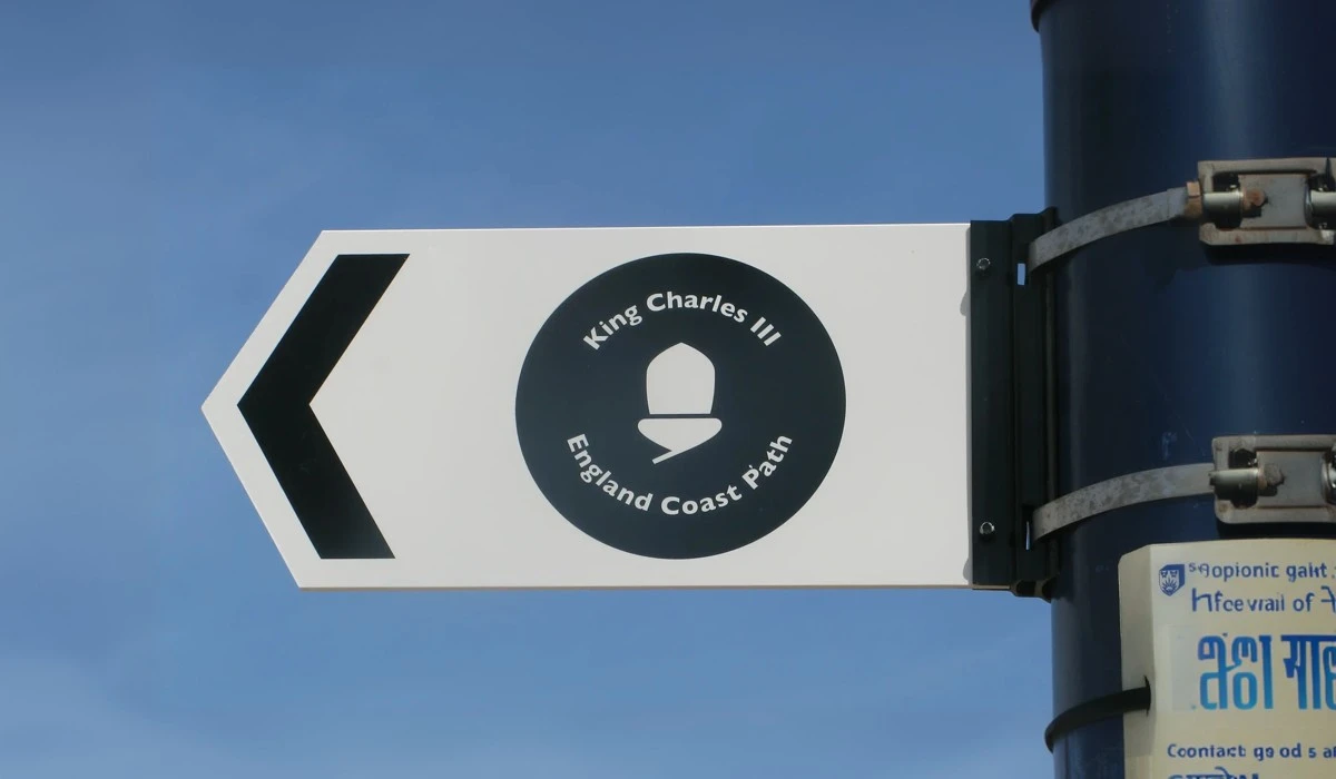
Organizers divided the colossal geographical workload into five specific regions: North-East, East, South-East, South-West, and North-West. Mapmakers utilize very specific visual codes to guide hikers. They apply pink shading to designate the open coastal margin. They track the main physical trail using green diamonds. When temporary ecological issues arise, planners use hollow diamonds to indicate seasonal wildlife diversions. The route relies heavily on distinct visual branding, utilizing English flag colors and the widely recognized National Trail acorn symbol to mark wooden signposts along the cliffs. These icons guide travelers safely through unfamiliar terrain.
Isle of Wight and the Seven Sisters Inauguration
Developers expanded their ambition beyond the mainland by securing an Isle of Wight addition. They engineered a 2.8-mile route passing directly through Gurnard Luck and Lynda's Woods. Crews even executed a difficult stairway installation down a steep cliff face to grant public access to a previously isolated "secret beach." When the time came to celebrate the project, officials chose a breathtaking location. The formal inauguration took place on the Seven Sisters chalk downland in East Sussex. This ceremony simultaneously established a brand-new National Nature Reserve right alongside the historic chalk cliffs, forever linking the trail with environmental conservation.
The Moving Legacy of the England Coast Path
A national monument defined by its edges is destined to change shape forever. Creating a permanent trail on a temporary terrain guarantees that the construction phase will never truly end.
Project Lead Neil Constable views the completion of this route as a peak career milestone. He argues that the core value of the initiative lies in providing unrestricted coastal access in either direction over the total distance. Planners successfully built an unbroken shoreline connection despite facing decades of political delays, massive funding hurdles, and constant environmental collapse. Constable insists that the harsh weather and rough terrain supply the essential elements of adventure, transforming a simple walk into an expedition.
The England Coast Path guarantees that anyone can walk the national maritime borders without asking for private permission. Nature will continue to chew away at the cliffs. The legal framework simply steps back and draws a new line. The trail survives because it never stops moving.
Recently Added
Categories
- Arts And Humanities
- Blog
- Business And Management
- Criminology
- Education
- Environment And Conservation
- Farming And Animal Care
- Geopolitics
- Lifestyle And Beauty
- Medicine And Science
- Mental Health
- Nutrition And Diet
- Religion And Spirituality
- Social Care And Health
- Sport And Fitness
- Technology
- Uncategorized
- Videos